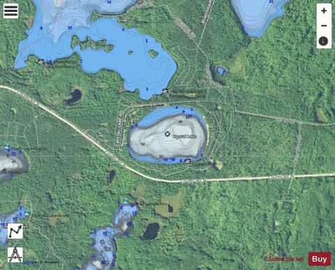
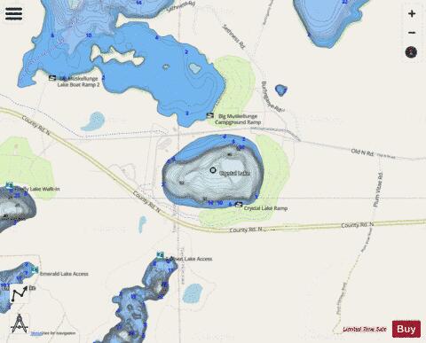
Crystal Lake fishing map is available as part of iBoating : USA Marine & Fishing App(now supported on multiple platforms including Android, iPhone/iPad, MacBook, and Windows(tablet and phone)/PC based chartplotter.).
With our Lake Maps App, you get all the great marine chart app features like fishing spots, along with Crystal Lake depth map. The fishing maps app include HD lake depth contours, along with advanced features found in Fish Finder / Gps Chart Plotter systems, turning your device into a Depth Finder. The Crystal Lake Navigation App provides advanced features of a Marine Chartplotter including adjusting water level offset and custom depth shading. Fishing spots and depth contours layers are available in most Lake maps. Lake navigation features include advanced instrumentation to gather wind speed direction, water temperature, water depth, and accurate GPS with AIS receivers(using NMEA over TCP/UDP). Autopilot support can be enabled during ‘Goto WayPoint’ and ‘Route Assistance’.
Now i-Boating supports Fishing Points in Crystal Lake.
Have more questions about the Nautical Chart App? Ask us.
Fishing Info for Crystal Lake
Crystal Lake is one of at least 22 lakes of in the state of Wisconsin. It has a surface area of about 93 acres, and is located just south of Big Muskellunge Lake, in Vilas County in the Northern Highland region of Wisconsin. The nearest community is Sayner, about 5 miles to the east. Visitors have access to the lake from a public boat landing, public beaches and the Northern Highland-American Legion State Forest. Fish include panfish, largemouth bass, and trout. Crystal Lake is a seepage lake, having neither tributary nor effluent. The lake has a maximum depth of 67 feet and a mean depth of 34 feet. The lake has very clear water, comparable to that of Lake Tahoe in California, or Crater Lake in Oregon.
More on Wikipedia...Popular fish species in this lake include Largemouth bass and Panfish.
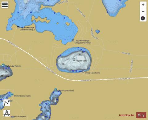
Crystal Lake Fishing Map Stats | |
| Title | Crystal Lake |
| Scale | 1:3000 |
| Counties | Vilas |
| Nearby Cities | Sayner, Arbor Vitae, Boulder Junction, Woodruff, Saint Germain, Minocqua, Lake Tomahawk, Hazelhurst, Presque Isle, McNaughton |
| Area * | 92.71 acres |
| Shoreline * | 1.41 miles |
| Min Longitude | -89.62 |
| Min Latitude | 46.00 |
| Max Longitude | -89.61 |
| Max Latitude | 46.00 |
| Edition Label 1 | |
| Edition Label 2 | |
| Edition Label 3 | |
| Id | US_WI_cr |
| Country | US |
| Projection | Mercator |
| * some Stats may include nearby/connecting waterbodies | |
|