Both iPhone Marine Navigation app and iPad Marine Navigation app include support for nautical charts/marine charts covering following regions. Both marine chart apps support all iOS devices running OS versions 4.3 and higher including the new iPhone 5 and iPad. The marine chart app also takes advantage of iOS background modes for GPS services when any of the marine navigation features (route assistance, auto follow etc.) is on.
Please click on the link below to download the marine chart app for iPad and iPhone directly from iTunes.
Download iPad/iPhone version from App Store
Supported iOS devices
All devices running iOS 4.3 or higher are supported.
Specifically the app supports iPhone 3GS, iPhone4, iPhone4S, iPhone5, iPad, iPad 3G, iPad 2, iPad 2 3G, iPad HD, iPad HD 4G, iPad Mini, iPad Mini 3G and iPod touch. Autonomous GPS / Built in GPS is used by the app if device supports it : while iPhones have a built in GPS, autonmous GPS is available only on iPad 3G, iPad HD 4G and iPad Mini 3G.
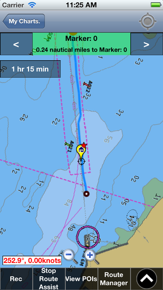
Features of iPhone/iPad marine charts app
A detailed description of all features supported in the app is available on the nautical chart app features page.
Some of the most commonly used features by iPhone users are included below:
- Route manager specially designed for iPhone (For routes/way points shared via email use open in 'Gps Nautical Charts')
- Offline chart storage on your iPhone or iPad
- Offline Route assistance with voice prompts using iPhone's autonomous GPS
- Pixel accurate route editing/creation on your iPhone
User Guide for iPhone/iPad
Some Frequently asked questions for iPhone App
Q. Does the iPhone version have support for inland lakes, waterways, reservoirs?
A. Yes the app includes coverage for inland lakes, waterways and reservoirs, in addition to the coastal data. Please checokut all regions supported by our app. If you find your lake or waterway missing, please let us know.
Q. Does the iPad version take advantage of full screen of the iPad or does it run in the iPhone only mode?
A. The iPad version takes advtange of full screen of the iPad.
Q. How can I create waypoints at a specific lat long coordinate on the iPhone?
A. If you know the latitude and longitude of a specifient location, you can create a way point using the following steps:
- With the chart opened, tap on "New WayPoint" on action bar at the bottom of the iPhone screen.
- Tap on Enter Lat Lon manually.
- Enter coordinates and tap on save.
If the coordinates are in degree-minute or degree-minute-second format, please set the appropriate coordinate type under Options.
Q. Can I download the iPhone version from your website?
A. The iPhone and iPad apps need to be downloaded directly from iTunes.
Q. How do I add routes and waypoints from GPX or KML files to the app?
A. Email the file to your self. Tap on the attachment and select "Open in Gps Nautical Charts".
Q. How do I share routes I have created with others?
A. You can share routes from your iPhone or iPad with others using the steps below:
- With t he chart opend select Route Manager from action bar -> Routes
- Tap on the routes you wish to share.
- Tap on Export button.
This would create an email with routes attached. You can send this email to those you wish to share routes with.
Q. How do I get voice prompts for route assistance?
A. You need to first create a route that you wish to follow. A route is essentially a collection of route points that one follows in succession to get from point 'A' to point 'B'. Once you have created the route you can use "Route Assistance" from the menu bar to follow it with assistance.
You can find more discussion regarding it in the Quick start guide for iPhone.