Automatic Boat Routing
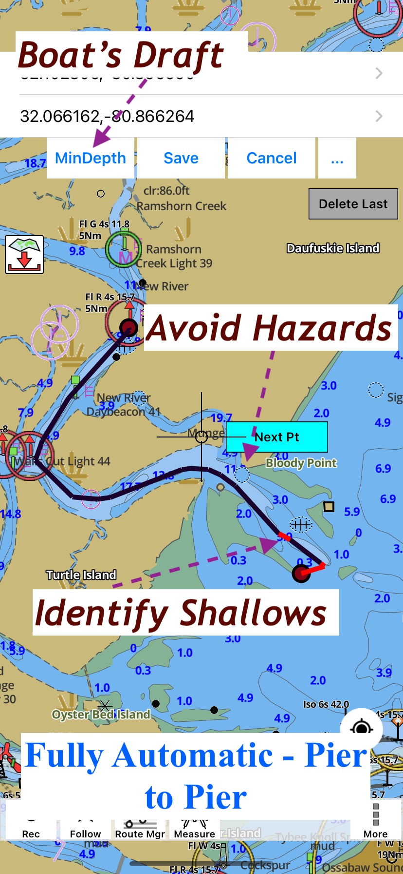
i-Boating kernel now supports auto routing for boats. Given a boat's draft, it automatically finds an optimal route (avoid hazards, shallows and still shortest, fastest, minimum fuel) between two points that is safe given the boat's draft. If a route leg goes through a corridor that is not safe for the boat, it is marked in red color.
- Avoid Hazards, obstructions: i-Boating has a comprehensive database of hazards/obstructions. The routing algorithm will automatically ignore such dangers to navigation.
- Safe for Boat's Draft: i-Boating has one of the most comprehensive bathymetric database. This depth database is used to find a route (if such a route exists) where in all depths are higher than the boat's draft. In case such a route does not exist, the i-Boating application will mark such route legs with red color.
- Optimal: The i-Boating routing AI tries to find the best route in terms of distance, fuel consumption requirements and time, while still making sure that it is safe.
-
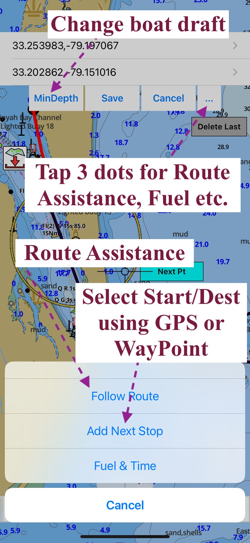
Multiple ways to choose end and start: The start and end destination can be selected in multiple ways:
- Select a point on Map
- Use Current Location
- Use an existing Way Point
- Multi Point Routing: The i-Boating application can compute route between multiple points in succession.
- Voice Activated Route Assistance: Route Assistance with moving map is also supported with automatically created routes.
- GPX Compatible: The automatically created routes can be saved in the route manager and exported as compressed GPX files.

Using Auto Routing with i-Boating
Auto Routing is supported in i-Boating on all platforms - Windows, MacOS, Android, iOS and Web.
To use auto routing, simply do the following:
- Press menu/more button and select Auto Route
- Select Start and End Point
The following annotaed screenshot where all the auto routing controls are in i-Boating.

