√Öngardsvatnet fishing map is included in √ėstfold nautical charts folio. It is available as part of iBoating : Norway Marine & Fishing App (now supported on multiple platforms including Android, iPhone/iPad, MacBook, and Windows(tablet and phone)/PC based chartplotter. ).
With our Lake Maps App, you get all the great marine chart app features like fishing spots, along with √Öngardsvatnet lake depth map. The fishing maps app include HD lake depth contours, along with advanced features found in Fish Finder / Gps Chart Plotter systems, turning your device into a Depth Finder. The √Öngardsvatnet Navigation App provides advanced features of a Marine Chartplotter including adjusting water level offset and custom depth shading. Fishing spots and depth contours layers are available in most Lake maps. Lake navigation features include advanced instrumentation to gather wind speed direction, water temperature, water depth, and accurate GPS with AIS receivers(using NMEA over TCP/UDP). Autopilot support can be enabled during ‚ÄėGoto WayPoint‚Äô and ‚ÄėRoute Assistance‚Äô.
Have more questions about the Nautical Chart App? Ask us.
Fishing Info for √Öngardsvatnet
√Öngardsvatnet is a lake in the municipality of Oppdal in Tr√łndelag county, Norway. The 3.24-square-kilometre (1.25 sq mi) lake lies in the Storlidalen valley, about 13 kilometres (8.1 mi) northwest of the village of L√łnset and about 35 kilometres (22 mi) west of the village of Oppdal. The lake is about 4.8 kilometres (3.0 mi) long and about 950 metres (3,120 ft) wide. It is surrounded by the Trollheimen mountain range including the mountains Gr√•fjellet, Kr√•kvasstind, and Lorth√ła to the south and B√•rdsgardskammen and Okla to the north. The lake Gjevillvatnet lies in the next valley to the north of √Öngardsvatnet.
More on Wikipedia...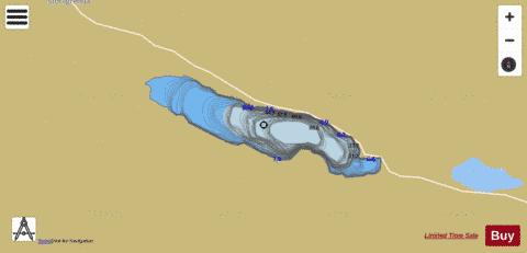
√Öngardsvatnet Fishing Map Stats | |
| Title | √Öngardsvatnet |
| Scale | 1:12000 |
| Min Longitude | 9.12 |
| Min Latitude | 62.66 |
| Max Longitude | 9.21 |
| Max Latitude | 62.68 |
| Edition Label 1 | |
| Edition Label 2 | |
| Edition Label 3 | |
| Id | NO_LK_2104 |
| Country | Norway |
| Projection | Mercator |
| * some Stats may include nearby/connecting waterbodies | |
|