Saylorville Lake fishing map is available as part of iBoating : USA Marine & Fishing App(now supported on multiple platforms including Android, iPhone/iPad, MacBook, and Windows(tablet and phone)/PC based chartplotter.).
With our Lake Maps App, you get all the great marine chart app features like fishing spots, along with Saylorville Lake depth map. The fishing maps app include HD lake depth contours, along with advanced features found in Fish Finder / Gps Chart Plotter systems, turning your device into a Depth Finder. The Saylorville Lake Navigation App provides advanced features of a Marine Chartplotter including adjusting water level offset and custom depth shading. Fishing spots and depth contours layers are available in most Lake maps. Lake navigation features include advanced instrumentation to gather wind speed direction, water temperature, water depth, and accurate GPS with AIS receivers(using NMEA over TCP/UDP). Autopilot support can be enabled during ‘Goto WayPoint’ and ‘Route Assistance’.
Now i-Boating supports Fishing Points in Saylorville Lake.
Have more questions about the Nautical Chart App? Ask us.
Fishing Info for Saylorville Lake
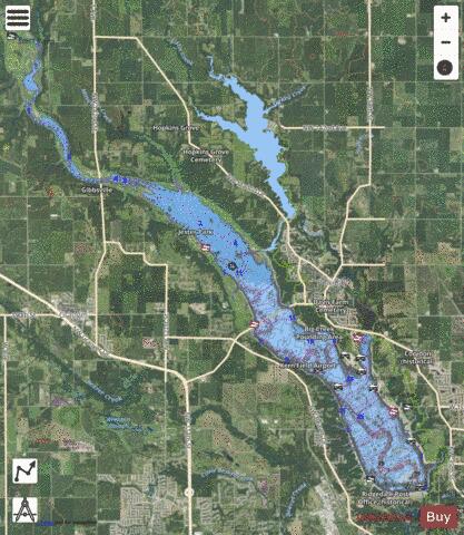
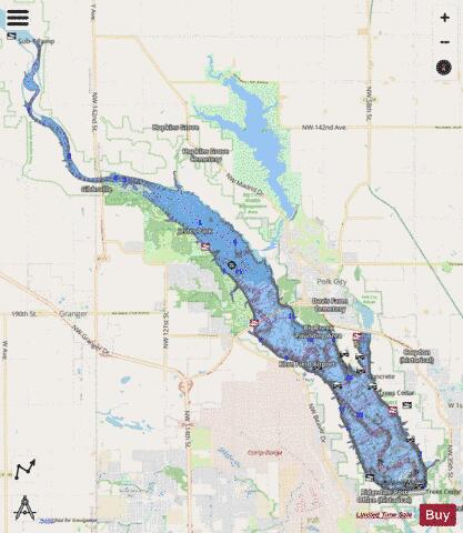
Saylorville Lake is a reservoir on the Des Moines River in Iowa, United States. It is located 11 miles (18 km) upstream from the city of Des Moines, and 214 miles (344 km) from the mouth of the Des Moines River at the Mississippi River. It was constructed as part of a flood control system for the Des Moines River as well as to aid in controlling flood crests on the Mississippi, of which the Des Moines is a tributary. The lake and dam is owned and operated by the U.S. Army Corps of Engineers, Rock Island District. At its normal level of 836 feet (255 m) above sea level, Saylorville Lake covers an area of 5,950 acres (24 km2) or 9.3 square miles (24.1 km2) and reaches some 17 miles (27 km) upstream. At full flood stage the lake can reach 16,700 acres (68 km2) or 26.1 square miles (67.6 km2) and reach 54 miles (87 km) long. At this point any further flow into the lake is channelled over an emergency spillway to the west of the main dam structure. The record high stage for the reservoir was 892.03 feet (271.89 m) above sea level set on July 11, 1993 during the Great Flood of 1993. Construction of the Saylorville Dam was authorized by Congress in 1958. Excavation began at the site in July 1965, becoming fully operational in September 1977. The dam itself is 6,750 feet (2,057 m) long, 105 feet (32 m) tall, and 44 feet (13 m) wide at the top. The lake is utilized for many recreational activities in the central Iowa area as well, as there is a large state park infrastructure surrounding the area of the lake, notably and Big Creek State Park. The Corps of Engineers operates several recreation areas, campgrounds, and boat ramp facilities around the lake. Boating and swimming are very popular, as are camping, deer and game bird hunting, fishing, hiking, biking and disc golf. Coast Guard Auxiliary Flotilla 4 provides boating safety education and free vessel safety checks to boaters in the area. Fish species that can be found in the lake include crappie, bluegill, green sunfish, largemouth bass, smallmouth bass, brown trout, northern pike, common carp, white bass, walleye, yellow bass, american eel, flathead catfish, channel catfish, bullheads, and hybrid striped bass. * Barrier Dam, the second dam impounding Saylorville Lake. View is to the southeast. * Spillway * Saylorville Lake in the winter as seen from an airplane
More on Wikipedia...Popular fish species in this lake include Ameiurus, American eel, Common carp, Crappie, Green sunfish, Largemouth bass, Northern pike, Smallmouth bass, Walleye and White bass.
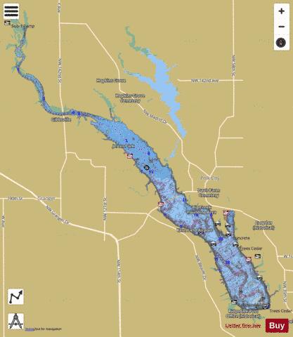
Saylorville Lake Fishing Map Stats | |
| Title | Saylorville Lake |
| Sailing Clubs in this Chart region | |
| Rathbun Yacht Club | |
| Scale | 1:12000 |
| Counties | Dallas, Polk |
| Nearby Cities | Polk City, Johnston, Madrid, Granger, Saylorville, Ankeny, Grimes, Woodward, Urbandale, Sheldahl |
| Area * | 5427.63 acres |
| Shoreline * | 51.74 miles |
| Min Longitude | -93.85 |
| Min Latitude | 41.70 |
| Max Longitude | -93.67 |
| Max Latitude | 41.85 |
| Edition Label 1 | |
| Edition Label 2 | |
| Edition Label 3 | |
| Id | US_IA_00461452 |
| Country | US |
| Projection | Mercator |
| * some Stats may include nearby/connecting waterbodies | |
|