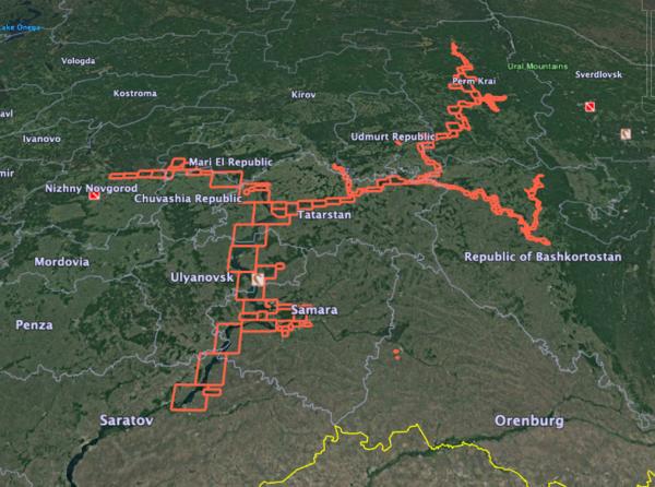
Here is the list of Volga-Kama region marine charts and fishing maps available on iBoating : Russia Marine & Fishing App. Marine charts app now supports multiple plaforms including Android, iPhone/iPad, MacBook, and Windows/PC based chartplotter. The Marine Navigation App provides advanced features of a Marine Chartplotter including adjusting water level offset and custom depth shading. Fishing spots and depth contours layers are available in most Lake maps. Nautical navigation features include advanced instrumentation to gather wind speed direction, water temperature, water depth, and accurate GPS with AIS receivers(using NMEA over TCP/UDP). Autopilot support can be enabled during ‘Goto WayPoint’ and ‘Route Assistance’. If marine chart / fishing map you are looking for is not listed in correct folio, please let us know.
This folio includes marine charts for Volga river from Nizhny Novgorod to Balakovo (Saratov hydropower):
It includes charts for following reservoirs/ regions.

- Volga river from the city of Nizhny Novgorod to the Volgograd hydroelectric complex
- Cheboksary, Kuibyshev, Saratov, Volgograd Reservoirs. Rivers: Sviyaga, Sura, Vetluga, Sviyaga, Kazanka, Cheremshan, Usa, Sok, Krivusha, Samara, Chapaevka, Chagra, Maly Irgiz, Saratovka
- Kama River Waterways
- The Kama River from the village of Kerch to the mouth. Kama, Votkinsk, Perm reservoirs. Rivers: Vishera, Yaiva, Inva, Obva, Sylva, Chusovaya, Belaya from the village of Simsky to the mouth. Vyatka River.

- Река Волга от города Нижний Новгород до Волгоградского гидроузла
- Чебоксарское, Куйбышевское, Саратовское, Волгоградское водохранилища. Реки: Свияга, Сура, Ветлуга, Свияга, Казанка, Черемшан, Уса, Сок, Кривуша, Самара, Чапаевка, Чагра, Малый Иргиз, Саратовка
- Водные пути реки Кама
