Lac La Plonge fishing map is included in Saskatchewan Fishing Maps nautical charts folio. It is available as part of iBoating : Canada Marine & Fishing App (now supported on multiple platforms including Android, iPhone/iPad, MacBook, and Windows(tablet and phone)/PC based chartplotter. ).
With our Lake Maps App, you get all the great marine chart app features like fishing spots, along with Lac La Plonge depth map. The fishing maps app include HD lake depth contours, along with advanced features found in Fish Finder / Gps Chart Plotter systems, turning your device into a Depth Finder. The Lac La Plonge Navigation App provides advanced features of a Marine Chartplotter including adjusting water level offset and custom depth shading. Fishing spots and depth contours layers are available in most Lake maps. Lake navigation features include advanced instrumentation to gather wind speed direction, water temperature, water depth, and accurate GPS with AIS receivers(using NMEA over TCP/UDP). Autopilot support can be enabled during ‘Goto WayPoint’ and ‘Route Assistance’.
Now i-Boating supports Fishing Points in Lac La Plonge.
Have more questions about the Nautical Chart App? Ask us.
Fishing Info for Lac La Plonge
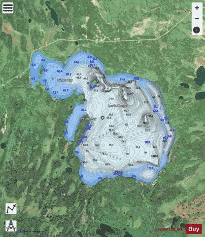
Lac la Plonge is a glacial lake in Saskatchewan in the basin of the Beaver River near Lac Île-à-la-Crosse. It is located in the Boreal Forest near the Canadian Shield. Lac La Plonge on its north shore is accessed via Highway 165. The La Plonge River flows west from the north west section of the lake into the Beaver River at Beauval. The lake is also the site of the Lac La Plonge Dam, which is operated by the Saskatchewan Water Security Agency.
More on Wikipedia...Popular fish species in this lake include Burbot, Cisco (fish), Lake trout, Lake whitefish, Longnose sucker, Northern pike, Sauger, Walleye, White sucker and Yellow perch.
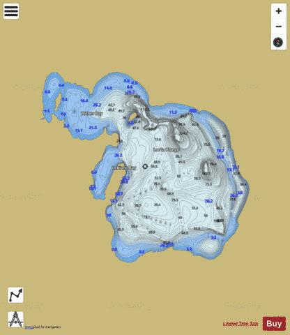
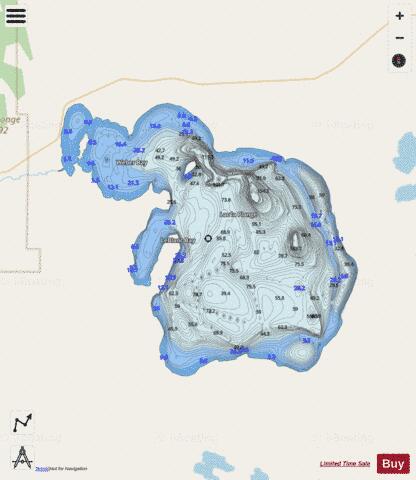
Lac La Plonge Fishing Map Stats | |
| Title | Lac La Plonge |
| Scale | 1:24000 |
| Area * | 59155.61 acres |
| Shoreline * | 68.17 miles |
| Min Longitude | -107.51 |
| Min Latitude | 55.03 |
| Max Longitude | -107.17 |
| Max Latitude | 55.20 |
| Edition Label 1 | |
| Edition Label 2 | |
| Edition Label 3 | |
| Id | CA_SK_plonge_lac_sk |
| Country | CA |
| Projection | Mercator |
| * some Stats may include nearby/connecting waterbodies | |
|