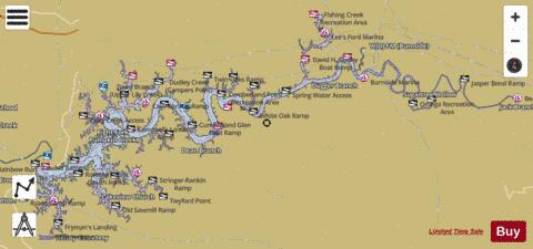
Lake Cumberland fishing map is available as part of iBoating : USA Marine & Fishing App(now supported on multiple platforms including Android, iPhone/iPad, MacBook, and Windows(tablet and phone)/PC based chartplotter.).
With our Lake Maps App, you get all the great marine chart app features like fishing spots, along with Lake Cumberland depth map. The fishing maps app include HD lake depth contours, along with advanced features found in Fish Finder / Gps Chart Plotter systems, turning your device into a Depth Finder. The Lake Cumberland Navigation App provides advanced features of a Marine Chartplotter including adjusting water level offset and custom depth shading. Fishing spots and depth contours layers are available in most Lake maps. Lake navigation features include advanced instrumentation to gather wind speed direction, water temperature, water depth, and accurate GPS with AIS receivers(using NMEA over TCP/UDP). Autopilot support can be enabled during ‘Goto WayPoint’ and ‘Route Assistance’.
Now i-Boating supports Fishing Points in Lake Cumberland.
Have more questions about the Nautical Chart App? Ask us.
Fishing Info for Lake Cumberland
Lake Cumberland is a reservoir in Clinton, Pulaski, Russell, Wayne, and Laurel, counties in Kentucky. The primary reasons for its construction were a means for flood control and the production of hydroelectric power. Its shoreline measures 1,255 miles (2,020 km) and the lake covers 65,530 acres (265 km2) at the maximum power pool elevation. The reservoir ranks 9th in the U.S. in size, with a capacity of 6,100,000 acre-feet (7.5 km3) of water, enough to cover the entire Commonwealth of Kentucky with 3 inches (76 mm) of water. The main lake is 101 miles (163 km) long and over one mile (1.6 km) across at its widest point. The lake has become a major source of tourism and an economic engine for south-central Kentucky. As of September 2011 Lake Cumberland was approximately 43 feet (13 m) below its normal level due to leakage in the earthen part of the dam, but repairs were completed in 2013 and officials estimated that lake levels would be back to normal by 2014–2015. As of April 18, 2015, the lake is back to full summer pool.
More on Wikipedia...Popular fish species in this lake include Lake trout, Rainbow trout, Sauger, Striped bass and Walleye.
Lake Cumberland Fishing Map Stats | |
| Title | Lake Cumberland |
| Scale | 1:12000 |
| Counties | Clinton, McCreary, Pulaski, Russell, Wayne |
| Nearby Cities | Hargis, Burnside, Jamestown, Elihu, Cumberland City, Ferguson, Steubenville, Nancy, Creelsboro, Monticello |
| Area * | 38794.90 acres |
| Shoreline * | 663.41 miles |
| Min Longitude | -85.19 |
| Min Latitude | 36.76 |
| Max Longitude | -84.36 |
| Max Latitude | 37.12 |
| Edition Label 1 | |
| Edition Label 2 | |
| Edition Label 3 | |
| Id | US_KY_00490483 |
| Country | US |
| Projection | Mercator |
| * some Stats may include nearby/connecting waterbodies | |
|


