Bluestem Lake fishing map is available as part of iBoating : USA Marine & Fishing App(now supported on multiple platforms including Android, iPhone/iPad, MacBook, and Windows(tablet and phone)/PC based chartplotter.).
With our Lake Maps App, you get all the great marine chart app features like fishing spots, along with Bluestem Lake depth map. The fishing maps app include HD lake depth contours, along with advanced features found in Fish Finder / Gps Chart Plotter systems, turning your device into a Depth Finder. The Bluestem Lake Navigation App provides advanced features of a Marine Chartplotter including adjusting water level offset and custom depth shading. Fishing spots and depth contours layers are available in most Lake maps. Lake navigation features include advanced instrumentation to gather wind speed direction, water temperature, water depth, and accurate GPS with AIS receivers(using NMEA over TCP/UDP). Autopilot support can be enabled during ‘Goto WayPoint’ and ‘Route Assistance’.
Now i-Boating supports Fishing Points in Bluestem Lake.
Have more questions about the Nautical Chart App? Ask us.
Fishing Info for Bluestem Lake
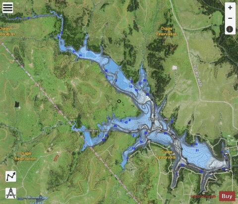
Bluestem Lake is a reservoir in Osage County, Oklahoma, and is home to the world famous Plan B Yacht Club, it's about 4.5 miles (7.2 km) northwest of Pawhuska. Alternate names are City of Pawhuska Lake and Pawhuska Lake. It covers the convergence of Middle Bird Creek and South Bird Creek. The outflow is Middle Bird Creek. The lake has a surface of 762 acres (3.08 km2) and a shoreline of 19 miles (31 km). Coordinates are:Latitude: 36°42'19.7" Longitude: -96°25'9.06". Elevation above sea level is 267 metres (876 ft). Completed in 1958, the lake is a secondary water source for Pawhuska and also was designed for flood control and recreation.
More on Wikipedia...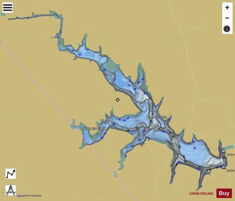
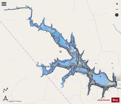
Bluestem Lake Fishing Map Stats | |
| Title | Bluestem Lake |
| Scale | 1:12000 |
| Counties | Osage |
| Nearby Cities | Pawhuska, Nelagoney, Wynona, Foraker, Shidler, Herd, Barnsdall, Hominy, Gray Horse, Webb City |
| Area * | 865.06 acres |
| Shoreline * | 22.64 miles |
| Min Longitude | -96.46 |
| Min Latitude | 36.69 |
| Max Longitude | -96.40 |
| Max Latitude | 36.73 |
| Edition Label 1 | |
| Edition Label 2 | |
| Edition Label 3 | |
| Id | US_OK_bluestem |
| Country | US |
| Projection | Mercator |
| * some Stats may include nearby/connecting waterbodies | |
|