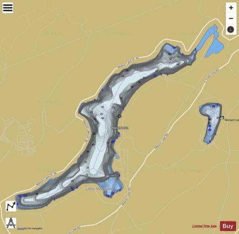
Mason Lake fishing map is available as part of iBoating : USA Marine & Fishing App(now supported on multiple platforms including Android, iPhone/iPad, MacBook, and Windows(tablet and phone)/PC based chartplotter.).
With our Lake Maps App, you get all the great marine chart app features like fishing spots, along with Mason Lake depth map. The fishing maps app include HD lake depth contours, along with advanced features found in Fish Finder / Gps Chart Plotter systems, turning your device into a Depth Finder. The Mason Lake Navigation App provides advanced features of a Marine Chartplotter including adjusting water level offset and custom depth shading. Fishing spots and depth contours layers are available in most Lake maps. Lake navigation features include advanced instrumentation to gather wind speed direction, water temperature, water depth, and accurate GPS with AIS receivers(using NMEA over TCP/UDP). Autopilot support can be enabled during ‘Goto WayPoint’ and ‘Route Assistance’.
Now i-Boating supports Fishing Points in Mason Lake.
Have more questions about the Nautical Chart App? Ask us.
Fishing Info for Mason Lake
Mason Lake is a natural elongated lake south of Belfair, Washington, United States in Mason County. Named for Charles H. Mason, the first secretary of Washington Territory, the lake is on the isthmus of the Kitsap Peninsula between the Hood Canal and Pickering Passage of the Case Inlet. The smaller Benson Lake is to its eastern side. Mason Lake is approximately 1000 acres in size and four miles long. Its maximum depth is 90 feet and the mean depth is 48 feet. With 10.9 miles of shoreline, the lake sits at 194 feet above sea level. More than a thousand residents live yearlong around the shores of Mason Lake, the second largest freshwater lake in Mason County, second to the manmade Lake Cushman to its northwest. Originally a summer vacation community, the lake has always been known for its power boats, jet skis and water skiing. A county park provides picnic and boat launching access. Swimming is limited to private access parks and residences. The single lane boat launch is on the steeper side and winches tend to get jammed if they're in the locked or retrieval state. The community of Mason Lake is located centrally between Grapeview and Harstine Island to the east, and Twanoh State Park to the west. Much of the area surrounding Mason Lake is commercial timberland in various states of harvest.
More on Wikipedia...Mason Lake Fishing Map Stats | |
| Title | Mason Lake |
| Scale | 1:12000 |
| Counties | Mason |
| Nearby Cities | Tahuya, Grapeview, Allyn, Union, Belfair, Shelton, Vaughn, Skokomish, Hoodsport, Home |
| Area * | 999.24 acres |
| Shoreline * | 11.80 miles |
| Min Longitude | -122.99 |
| Min Latitude | 47.32 |
| Max Longitude | -122.92 |
| Max Latitude | 47.36 |
| Edition Label 1 | |
| Edition Label 2 | |
| Edition Label 3 | |
| Id | US_WA_01506501 |
| Country | US |
| Projection | Mercator |
| * some Stats may include nearby/connecting waterbodies | |
|


