Lake Simcoe fishing map is included in Ontario Lakes nautical charts folio. It is available as part of iBoating : Canada Marine & Fishing App (now supported on multiple platforms including Android, iPhone/iPad, MacBook, and Windows(tablet and phone)/PC based chartplotter. ).
With our Lake Maps App, you get all the great marine chart app features like fishing spots, along with Lake Simcoe depth map. The fishing maps app include HD lake depth contours, along with advanced features found in Fish Finder / Gps Chart Plotter systems, turning your device into a Depth Finder. The Lake Simcoe Navigation App provides advanced features of a Marine Chartplotter including adjusting water level offset and custom depth shading. Fishing spots and depth contours layers are available in most Lake maps. Lake navigation features include advanced instrumentation to gather wind speed direction, water temperature, water depth, and accurate GPS with AIS receivers(using NMEA over TCP/UDP). Autopilot support can be enabled during ‘Goto WayPoint’ and ‘Route Assistance’.
Now i-Boating supports Fishing Points in Lake Simcoe.
Have more questions about the Nautical Chart App? Ask us.
Fishing Info for Lake Simcoe
Lake Simcoe is a lake in southern Ontario, Canada, the fourth-largest lake wholly in the province, after Lake Nipigon, Lac Seul, and Lake Nipissing. At the time of the first European contact in the 17th century the lake was called Ouentironk ("Beautiful Water") by the native Wendat/Ouendat (Huron) people. It was also known as Lake Taronto until it was renamed by John Graves Simcoe, the first Lieutenant-Governor of Upper Canada, in memory of his father, Captain John Simcoe of the Royal Navy. In Anishinaabemowin, the ancestral language of the First Nations living around this lake, namely Anishinaabek of Rama and Georgina Island First Nations, Lake Simcoe is called Zhooniyaang-zaaga'igan, meaning "Silver Lake".
More on Wikipedia...Popular fish species in this lake include Black crappie and Round goby.
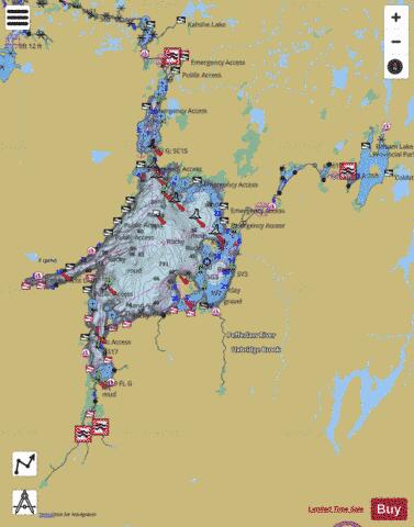
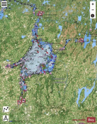
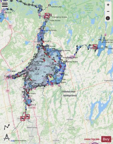
Lake Simcoe Fishing Map Stats | |
| Title | Lake Simcoe |
| This chart covers part of America’s Great Loop | |
| Scale | 1:48000 |
| Districts | Durham, Kawartha Lakes, Muskoka, Simcoe, York |
| Nearby Cities | Keswick - Elmhurst Beach, Sutton, Amigo Beach, Oro Station - Hawkestone, Beaverton, Orillia, Barrie, Innisfil, Bradford, Schomberg |
| Area * | 206504.63 acres |
| Shoreline * | 598.37 miles |
| Min Longitude | -79.69 |
| Min Latitude | 44.03 |
| Max Longitude | -78.79 |
| Max Latitude | 44.80 |
| Edition Label 1 | |
| Edition Label 2 | |
| Edition Label 3 | |
| Id | CA_ON_lake_simcoe_mm_on |
| Country | CA |
| Projection | Mercator |
| * some Stats may include nearby/connecting waterbodies | |
|