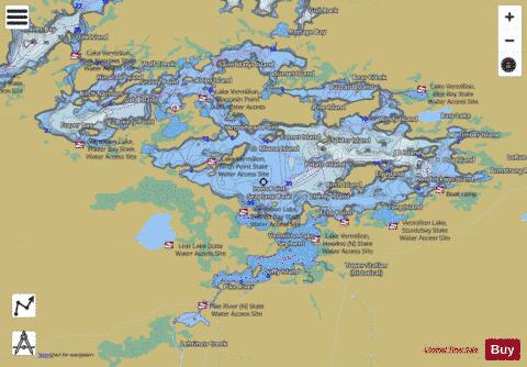
East Vermilion fishing map is available as part of iBoating : USA Marine & Fishing App(now supported on multiple platforms including Android, iPhone/iPad, MacBook, and Windows(tablet and phone)/PC based chartplotter.).
With our Lake Maps App, you get all the great marine chart app features like fishing spots, along with East Vermilion lake depth map. The fishing maps app include HD lake depth contours, along with advanced features found in Fish Finder / Gps Chart Plotter systems, turning your device into a Depth Finder. The East Vermilion Navigation App provides advanced features of a Marine Chartplotter including adjusting water level offset and custom depth shading. Fishing spots and depth contours layers are available in most Lake maps. Lake navigation features include advanced instrumentation to gather wind speed direction, water temperature, water depth, and accurate GPS with AIS receivers(using NMEA over TCP/UDP). Autopilot support can be enabled during ‘Goto WayPoint’ and ‘Route Assistance’.
Now i-Boating supports Fishing Points in East Vermilion.
Have more questions about the Nautical Chart App? Ask us.
Fishing Info for East Vermilion
Lake Vermilion is a shallow freshwater lake in northeastern Minnesota, United States. The Ojibwe originally called the lake Nee-Man-Nee, which means “the evening sun tinting the water a reddish color”. French fur traders translated this to the Latin word Vermilion, which is a red pigment. Lake Vermilion is located between the towns of Tower on the east and Cook on the west, in the heart of Minnesota's Arrowhead Region at Vermilion Iron Range. The area was mined from the late 19th century until the 1960s, and the Soudan Mine operated just south of the lake. The lake contains black crappie, bluegill, brown bullhead, largemouth bass, muskellunge (muskie), northern pike, pumpkinseed (sunfish), rock bass, smallmouth bass, tullibee (cisco), walleye, white sucker, and yellow perch. Lake Vermilion is known for its walleye and muskie fishing. In the spring of 2005, Lake Vermilion was host to the annual Minnesota Governor’s Fishing Opener Weekend. Many feel the increased population of muskies has had a detrimental effect on the walleye population. A four-walleye limit and a 17- to 26-inch protected slot limit took effect on Lake Vermilion in 2006. However, as the population rebounded, a new special regulation for walleye was introduced in May 2017. The new regulation is a 20 to 26 inch protected slot limit, with one fish over 26 inches allowed in a four fish possession limit. The lake attracts visitors from all parts of Minnesota and the midwestern United States, who lodge at the lake's numerous resorts and hotels. Tourists are drawn by Lake Vermilion's reputation as a fishing destination, as well as its setting in the northern Minnesota wilderness. The lake is near the Superior National Forest and the Boundary Waters Canoe Area Wilderness (BWCAW). The Minnesota DNR ranks Lake Vermilion as the fifth largest lake by surface area for bodies of water entirely within Minnesota borders. The surface area of Lake Vermilion is 39,271 acres (158.9 km2) and has a maximum depth of 76 feet (23 m). It is located within the southernmost section of the Canadian Shield, and contains over 365 islands. Some fish consumption guideline restrictions have, from time-to-time, been placed on some of the lake's fish due to mercury contamination. Consumption of Northern pike and walleye over 15 inches should not exceed twice a week, however vacation fishing consumption is unlimited. In 2007, Governor Tim Pawlenty announced the state was negotiating the purchase from U.S. Steel of a large area of land on the southeastern shore of the lake for a proposed new Minnesota state park. The sale of the land at a cost of $18m was finalized in June 2010. Once the land was acquired, a new park was created, which included the purchased parcel and the existing Soudan Underground Mine State Park. The new park is called Lake Vermilion-Soudan Underground Mine State Park. The Bois Forte Band of Chippewa has a small reservation on the lake, upon which is located Fortune Bay Resort and Casino. The Stuntz Bay Boathouse Historic District was constructed in the first half of the 20th century by employees of the adjacent Soudan Iron Mine on the shores of the lake.
More on Wikipedia...Popular fish species in this lake include Black crappie, Brown bullhead, Largemouth bass, Northern pike, Pumpkinseed, Rock bass, Smallmouth bass, Walleye, White sucker and Yellow perch.
East Vermilion Fishing Map Stats | |
| Title | East Vermilion |
| Scale | 1:24000 |
| Counties | St. Louis |
| Nearby Cities | Tower, Soudan, Angora, Embarrass, Britt, Cook, Buyck, Biwabik, Babbitt, McKinley |
| Area * | 28201.91 acres |
| Shoreline * | 241.41 miles |
| Min Longitude | -92.50 |
| Min Latitude | 47.78 |
| Max Longitude | -92.16 |
| Max Latitude | 47.92 |
| Edition Label 1 | |
| Edition Label 2 | |
| Edition Label 3 | |
| Id | US_MN_69037801 |
| Country | US |
| Projection | Mercator |
| * some Stats may include nearby/connecting waterbodies | |
|


